Friday, May 30, 2008

Brown Mountain Road--Mountain Biking


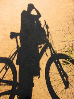
Yesterday I went mountain biking in the San Gabriel Mountains. I road the Brown Mountain Trail (a dirt fire road) near JPL. I haven't been mountain biking lately and I really would like to get back into it. I have done this trail before. I parked in the parking lot above JPL (Secco Rd?) and started my ride crossing a closed fire road gate. The ride is about 3.5 miles from the parking lot. I originally tried another trail (to the right of Brown Mt.) but the bridge had collapsed and they closed the trail. Brown Mountain is a steady incline for about 3 miles. This is an excellent work out, which I am in need of for training for Mt. Shasta this June. Anyhoo, I will try to ride a little farther each time. The climb kicked my butt but the ride down (all down hill basically) was awesome.

Check out my video! You can also see the path I took in Google maps or download the KML file to your Google Earth.

Riding stats:

Distance: 8 miles RT
Time: 50 minutes up 10 minutes down


View Larger Map

Tuesday, May 27, 2008

Mt. Baldy


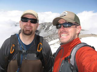
Today my buddy Cary and I hiked up Mt. Baldy. It was a beautiful day. There some snow left over from the storm a few days ago which made the mountain landscape that much better. We hiked from Manker Flat to Baldy Notch, Devils Backbone, and to the top of Mt. San Antonio(referred to as Mt. Baldy). The hike was 6 miles each way. The first 3 miles were on a fire road until we hit Baldy Notch (ski lifts). The Devils Backbone was more of a traditional trail, steep at some points. Since there was some snow we post holed a little but mostly went through sloshy snow. The clouds were hanging low and at about 8000 feet up we were above the cloud line giving us spectacular views! The weather and views were amazing. I have hiked this in the summer time without any snow but it just doesn't compare with the great white stuff!

Below is our route according to my GPS tracks.

This is a good local hike for training for Mt. Shasta. The summit is 10,000 feet. Oh, I also ran into one of the WTC leaders (edee) at the top.

Trip info:
  • Start: 8:30 summit @ 12:50 (15 minute break at the top)
  • End: 4:15
  • Total Miles: 12
  • Elevation start: 6100
  • Elevation @ summit: 10064
  • Total Elevation Gain: 3964


View Larger Map

Monday, May 26, 2008

Temescal Canyon Loop -- Skull Rock


Today I hiked the Temescal Canyon Loop Trail in Topanga Wilderness.  I parked at the intersection of Sunset Blvd and Temescal Canyon, it is otherwise 5 dollars to park inside the parking lot.  Anyway, this hike is very popular and fairlycrowded.  I had a heavy pack on in preparation for Mt. Shasta, so I got a pretty good work out in.  The loop itself is only 2.8 miles but I veered off a little and went a little past Skull Rock to gain some elevation and distance.  It was also less crowded up there.  The TCL has beautiful views of downtown LA and the Santa Monica coastline.  There was a small bridge that went over a creek but it hardly had any water flowing in it.  Trail signs claim it's a waterfall but nothing was falling when I was there except a few drops of water.  I ate lunch about 1/4 mile north of skull rock, from there I could see the Temescal Canyon trail extending further into the mountains.  When I have more time I will have to do some exploring. 

I brought my GPS unit and tracked the hike.  I also learn of this cool open source software that will sync up my GPS track and photos together so that on the Google map path the photos inserted are actually where I was standing when I took the photograph.... pretty killer stuff!

Trip info:
  • Elevation start 350 ft
  • Elevation at the top 1400 ft
  • Total elevation gain 1050 ft
  • Total Miles 4.5
  • Time 2 hrs
  • Great views of downtown and coastline, but very busy and crowded.


View Larger Map

Wednesday, May 14, 2008

Mountain Biking--Sullivan Canyon

On Monday my two buddies from work (Justin and Eric) and I went mountain biking up near Brentwood(Sullivan Canyon near Paul Revere Middle School). I haven't been mountain biking for a long time. I have had my slick tires on my mountain bike for riding on the streets but Sunday I switched back to my mountain tires. We all had a blast. I forgot how much fun mountain biking is. The trail we went on was awesome, it had long narrow turns,water crossings, jumps(which I did not par take in) and hills. Once we got to the top of the ridge we could see the Valley, Santa Monica(or just south of SM) and Downtown. It was quite a spectacular view. After taking a little breather at the top we charged back down the trail. Man was that awesome, passing through water, rocks, logs, and bushes. I was pretty dirty and spent by the time we got back.

Trip Info:
  • start 4:30
  • return 7:00
  • 75% single track
  • Mileage: ?
  • Elevation: ?

Trip Highlights:.
  • My flat tire
  • Justin eating it....in style! "I'm really liking the flow" JS
  • Tick found on my thigh later that night
  • Eric's wheel falling off
  • Spectacular 360 degree views from the top

Sunday, May 11, 2008

Joshua Tree Climbing-- (Hidden Valley)


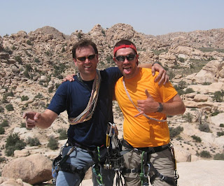
Yesterday my buddy Tom and I went to Joshua Tree to do some Trad Climbing. Trad climbing is when one person (the lead) climbs up the route and places anchors while being belayed from the bottom. When the lead person reaches the top, he then belays the bottom person up while the bottom person takes out (cleans) the anchors set by the lead person. Tom was the lead climber on our climbs, he is an experienced climber that has been teaching me the ropes...haha literally!

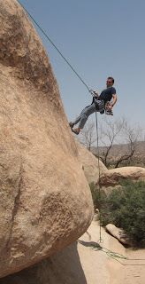
We went to Hidden Valley which is a very popular climbing spot. It was a beautiful day, about 80 degrees and clear. All our climbs were in in sun so we were pretty beat after our third climb. We had an awesome time. We rappelled off toe jam and the last 20 feet was a free rappel (hanging in the air, no feet on the rock, I included a photo of it).

         Climbs:
  • Toe Jam: 5.7 
  • Mike's Books 5.6 (this is a 2 pitch climb, we only did the first pitch and then free climbed a little bit before rapping off)
  • The Bong: 5.4 (this was a crack climb that kicked my butt. it was our last climb and I thought it was harder than the other two climbs. beware: at the top of the Bong there are no bolts just one piece of webbing to rap off. Tom had to "donate" 2 carabiners.)

Monday, May 5, 2008

Bridge to Nowhere....."smells like fresh rain" KD


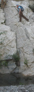
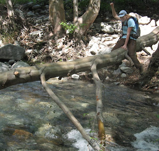
Today Cary, Katie and I hiked from East Fork Ranger Station to Narrows. This is commonly referred to as the Bridge to Nowhere hike. There was a killer bridge built that ran right into the side of the mountain. It looks quite odd. This hike was one of my favorites amongst the San Gabriels. The hike followed the stream (flowing pretty well) for about 4.5 miles until the bridge. During the hike we bouldered, crossed streams on fallen trees, walked through calf deep water and saw people bun-gee jump off the bridge. It was a perfect day. I strongly recommend this hike. I will definitely have to do it again.

trip log:
9 miles RT
left 9:30 bridge@ 12:20
left bridge@12:50 returned by 3:30
1100 ft elevation gain

note: bring a spare set of clothes so you can soak in the narrows to cool off.


View Larger Map