Cary and me on top of Tabeguache

One needs to cross a stream some how

Katie climbing up


2 pics I shot near our camp

Katie and Sis on top of Tabeguache

Brad, Kris and me climbing up Tabeguache

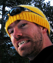
Me rocking my new hat

Cary climbing up the snow shoot

Climbing up the snow shoot
Around 4:15 we arrived at the lake and set up our tents just north of there. Cary and I were bunking together as usual, Katie was with her sis and Brad and Kris were together. Cary and I have camped so many times together I feel we are a well oiled machine, very proficient at setting up camp. That night we set up a camp fire and relaxed. I tried capturing water blur photographs near the creek near by but nothing really turned out to my liking.
The next morning we woke up around 5:30 and got ready for our climb. We headed out of our camp (11,300 ft) by 6, just as the sun was painting the mountains a nice shade of pink. We climbed up a gully filled with scree and loose rock for the first hour and a half. Around 12,500 we started climbing up a ridge, luckily climbers above us showed us which route "not" to take. While climbing up the ridge a climber above knocked down a bowling ball size boulder down the shoot and went whizzing past us. It wasn't close enough to hit us but it was heading towards where we were before we started climbing the ridge. None the less it definitely got our attention. After climbing up the ridge we traversed to a snow shoot in a gully and climbed straight up until we hit the saddle (13,800 ft), which connects Shavano and Tebeguache. Brad and Kris did a terrific job kicking in steps up the hard pack snow! Once at the saddle we climbed up to Tabeguache (14,155 ft). There was a small cornice that we climbed over to reach the summit (roughly around 10:30). Once on the summit we relaxed for about 20 minutes with the 5 of people who were already there. Katie also brought chocolate for all of us as well. Thanks Katie, you rock!
We soon headed back down to the saddle and left some gear there as we hiked along the Mt. Shavano ridge to Shavano's summit. It took us about 30 minutes to reach Shavano's summit (14,229 ft). Once there we met a guy who put an American flag on the summit. After a picture I headed back down to the saddle where I ate my salami, cheese and cracker lunch. Kris hung back a little and sang the star-spangled banner with the patriotic climber:-)
On our decent, going down the snow shoot was a little tougher that I expected. I had hoped the snow would be punchy and easy to heal step down. It was definitely manageable but not as soft as I would have liked, so the last 40 feet I got on my butt and glissaded down. We arrived back at our camp around 1:30. The rest of the day we relaxed around the camp site. I took some photos, took a nice nap and then sat around the campfire and discussed important topics like swamp @$$ and the town of Rifle.
The next morning Cary, Kelsy and I headed back down to our cars. Cary and I needed to start our drive back to California. Brad, Kris and Katie stayed and climbed Mt. Antero, good job guys!
Weather:
The weather was great the whole weekend. We did encounter a thunderstorm in the middle of the night one night but that's about it. It was cloudy on and off throughout the weekend.
Stats:
- Brown Creek Trailhead: 8,950 feet
- Brown Creek Lake (Camp): 11,300 feet / 6 miles from trailhead
- Saddle: 13,800 feet
- Tabeguache : Peak: 14,155 feet / about 1.5 miles from Brown Creek Lake (our camp)
- Mt. Shavano : 14,229 feet / about .5 miles from saddle
Lessons learned:
- Subways in Colorado don't offer avocados
- The town of Rifle has the best Starbucks ever (ask Cary)
- You must drive a Subaru to live in Colorado
- Mini tripods take terrible water blur photos, too low to the ground.
- Mel and I should move to Colorado
** Thanks to Kelsy, Katy and Cary for contributing their photographs to the blog.
** Thanks to Brad and Katie for planning such an awesome trip!!!