Last November Cary and I went up to the Sierras to backpack into the Meyson Lakes via the Whitney Portal. When we got up to the portal it was extremely cold and the water had been shut off so we had to get water via the stream that had partially froze over. We started hiking up the Meyson Lake trail to find that the further we went the farther away from the stream was, we knew once we got up to the Lakes there would be water but didn't know if the lakes were frozen over or not. A few miles into the hike we noticed the stream was pretty much frozen over, it had been in the teens at night and the twenties during the day so freezing water was an issue. Even my nalgene frozen up on me. We decided to turn around and just camp and the Portal. It was very cold, probably in the teens that night as well. Water was freezing on us so we had to keep all our water in our sleeping bags at night. The next morning we decided to do a day hike of the Mountaineers Route of Mt. Whitney. We had a fun time scrambling up rocks and exploring the terrain that makes up the Mountaineers Route. When hiked back to the Portal we decided to go down and explore Alabama Hills which is at the base of the Portal Road. This area is great for photography, open space with a ton of boulders strewn about with the Sierras as a nice backdrop. That night we spent the night in a cheap motel because I didn't feel like freezing my butt off again! The next morning we got up before sunrise to explore and hike around Alabama Hills some more. All and all it was a good time. Below are time-lapses I shot of Alabama Hills.
Mr. Down
Cary climbing up the Mountaineers Route
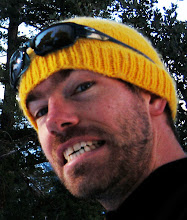
Why are we happy?- We were about to make hot chocolate!