Last November Cary and I went up to the Sierras to backpack into the Meyson Lakes via the Whitney Portal. When we got up to the portal it was extremely cold and the water had been shut off so we had to get water via the stream that had partially froze over. We started hiking up the Meyson Lake trail to find that the further we went the farther away from the stream was, we knew once we got up to the Lakes there would be water but didn't know if the lakes were frozen over or not. A few miles into the hike we noticed the stream was pretty much frozen over, it had been in the teens at night and the twenties during the day so freezing water was an issue. Even my nalgene frozen up on me. We decided to turn around and just camp and the Portal. It was very cold, probably in the teens that night as well. Water was freezing on us so we had to keep all our water in our sleeping bags at night. The next morning we decided to do a day hike of the Mountaineers Route of Mt. Whitney. We had a fun time scrambling up rocks and exploring the terrain that makes up the Mountaineers Route. When hiked back to the Portal we decided to go down and explore Alabama Hills which is at the base of the Portal Road. This area is great for photography, open space with a ton of boulders strewn about with the Sierras as a nice backdrop. That night we spent the night in a cheap motel because I didn't feel like freezing my butt off again! The next morning we got up before sunrise to explore and hike around Alabama Hills some more. All and all it was a good time. Below are time-lapses I shot of Alabama Hills.
Mr. Down
Cary climbing up the Mountaineers Route
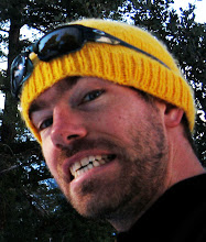
Why are we happy?- We were about to make hot chocolate!
At the beginning of August Melissa and I went to Belize for our babymoon. We stayed on Caye Caulker which is a small island just off the coast of Belize City. We spent our time relaxing and chilling before we had to leave the island due to hurricane Ernesto.
There was great snorkeling and diving near Caye Caulker. Below is a video from my snorkeling adventures. Most of it was shot near the reef just off the coast of Caye Caulker. It was about a 10 minute boat ride out.
On Saturday morning Cary and I met up to climb Mt. Baldy. On Friday Baldy got 2 feet of snow which was exciting, especially since it's been such a dry winter this season. We got to the trailhead (Manker Flats) and start climbing by 6:30. There were only a few people ahead of us so the trail was not packed down and caused us to go a little slower than normal. By 10 we reached the Sierra Hut. After a short break we started up the bowl. We decided to climb a more direct route to the summit which involved breaking trail. For 900 feet we were climbing up the bowl taking turns breaking trail. We would sink in shin to knee high which is a pain when on a steep (relatively speaking) angle. After 2 hours of climbing up we were beat. At 9,100 feet and a mile short of the summit we called it a day. The most enjoyable part of the climb was glissading down the bowl. It was slow going due to the soft powder but it was still doable. It only took 15 minutes to get back down to the Hut. Once at the Hut the trail was packed down due to more traffic. This made for a fast pace back to the car. All in all we climbed 3,000 feet and traveled 5 miles. It was disappointing not to make the summit but it was still great to get out and enjoy some much needed snow.
For Spring break Cary and I flew out to Colorado to meet up with Katie to do some BC/AT skiing. We rented a portion of Vance's cabin. It's part of the 10th mountain division hut system. We skied in 2.5 miles to Vance's cabin where we stayed for 3 nights. The cabin had lights and a stove, an outhouse in the back but we had to melt snow for water. We shared the cabin with about 9 other people that seemed to be pretty cool.
On Tuesday we skied in and unpacked. The cabin had a beautiful view of the snow capped mountains and at night stars were all around us. Just beautiful. The winter has been very warm and dry this year. It hadn't snowed in weeks and unfortunately the snow was pretty crusty. Occasionally we had to take our skis off and walk over bare spots on the trail. On Wednesday we took our time getting out of bed and made some breakfast. Cary, Katie, and I were each responsible for making one dinner and one breakfast for the 3 days we were there. Around mid day we headed out on our skis for a day trip. We skied about 1.5 miles. We then got our beacons out to practice our searching. Katie and Cary had formal beacon training before and they did a great job filling me in. One person would go burry the beacon while the 2 others used the other beacon to find it. This is essentially what you would do if someone got buried in an avalanche. As an extra incentive for me to find the beacon Katie and Cary buried Jelly Bellies with the beacon. When we returned back to the cabin Katie introduced us to the board game "Settlers of Catan". We instantly were hooked and played with our other cabin mates.
On Thursday we took a day trip and skied up "Taylor's Hill" this was about 1 mile with about 800 feet of elevation gain. Taylor's Hill was at the top of a ridge where we had 360 degree views of the surrounding mountains. Amazing! It was also nice to be out of the dense trees as well. After exploring the long ridge for awhile we took off our skins and skied down. But before we got all the way back to the cabin we stopped and dug a pit and did some snow pack testing. Cary pulled out a snow saw we used to cut out blocks and analyze the different layers. It's just another precaution to use in the backcountry to avoid dangerous avy conditions. After the snow pack test we skied back down to the cabin. It's nice, right near the cabin is about 3 hundred feet of open mountain to ski down without too many trees. That night we set up a tripod and camera and set the exposure to "bulb" to get a 20 minute exposure while we climbed up and skied down with our head lights on.
Of Friday we packed up, said goodbye to our cabin mates and skied back to the trailhead. Up to this point I didn't have any significant spills but unfortunately on our way back I ate it trying to avoid a log while keeping my skis on a narrow patch of snow. I fell forward and landed on my knee and forearm. Luckily I just got a few scrapes and a bruised ego. Katie commented shortly after, "I think you have a twig in your nose". After avoiding many bare spots we made it back to the car. It was a great trip with poor snow. I'm looking forward to next hut trip and hopefully getting fresh snow while we are out there!
Today Cary and I hiked Mt. Baldy. We were hoping to get some climbing in with our crampons for the first time this season, but as we were driving up to the trailhead we saw the bowl mostly clear of any traces of snow. Ugh, it's been a really warm winter in California and we haven't had enough coverage to do any climbing in So Cal. Regardless, it's always nice to train and get a good hike in. We started at 6:30 reached the Hut around 8:15 and summitted by 10:30. There were patches of snow but nothing worth while, mainly just loose scree. We decided to hike back down a different route, the Devil's Backbone. We figured we would scout out any possible bc ski routes once we're more skilled at bc skiing. Unfortunately, the ridge is really steep and wont be an option for us for future skiing. We hiked from Devil's Backbone to the Baldy Ski area, from there we hiked back down the long dirt road to the trailhead. The hike down the road was too long and boring. It was nice to scout out the route but I think we'll stick with the Hut route up and down in the future. We finally arrived back at the car around 1:45. In all the hike was about 10 miles.